Bring the campsites you have already found. The water that was actually running, the mines worth the detour, the hot springs, the two‑tracks you want to remember next season. Most apps get slow and unhelpful a few hundred pins in — this one is built for tens of thousands of them, and it goes on your phone for the places the signal does not.
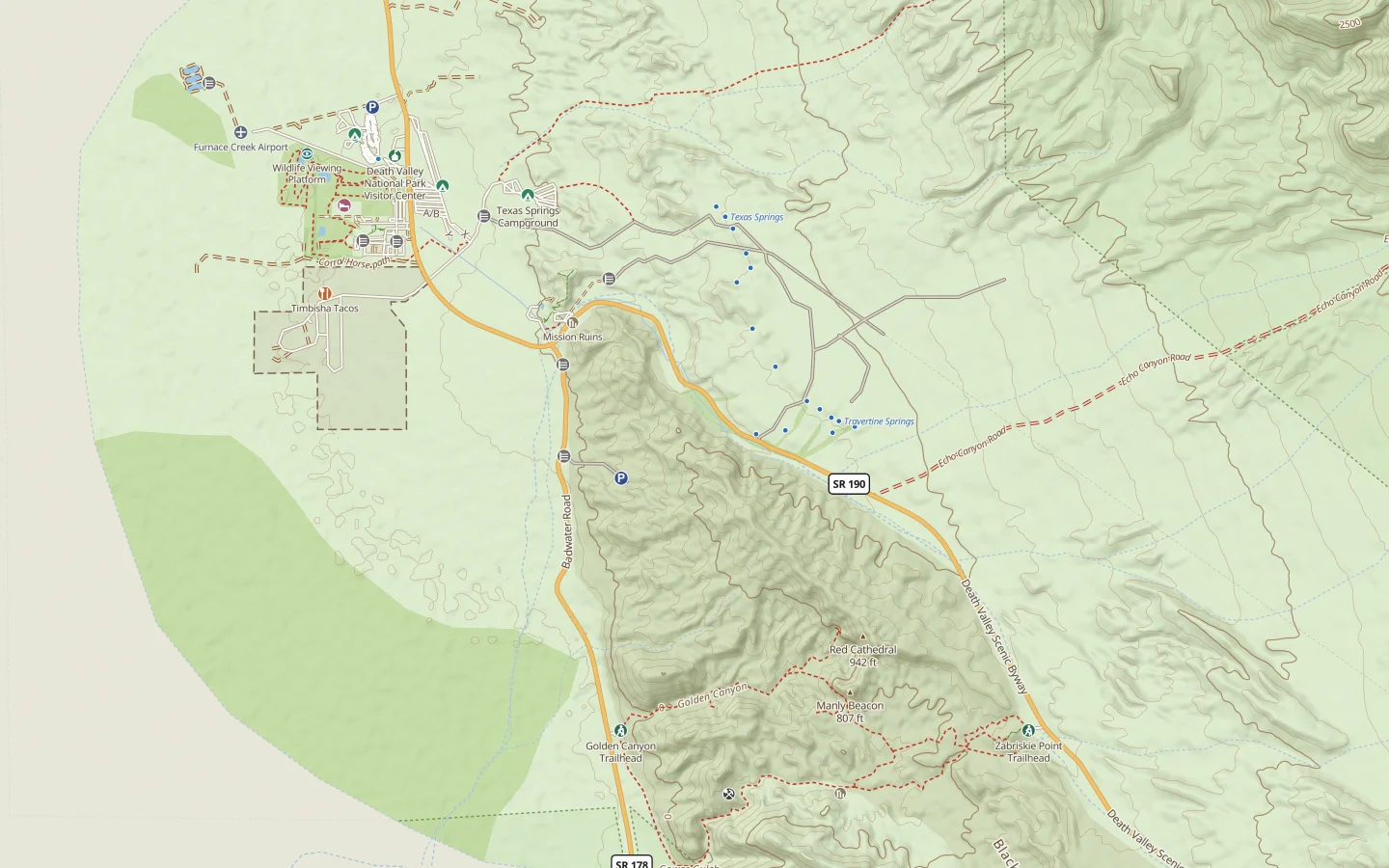
And it is one map, not half a dozen. Terrain, roads, trails, the places worth stopping for, your own waypoints and whatever basemap you like to bring — all on one screen, offline. No switching between one app for topo, another for trails, a browser tab for the road you are not sure about, and a printout on the passenger seat.
What it does
- Room for all of your waypoints on one map. Import GeoJSON, GPX or KML, or drop them as you go. Nested folders, search, filters and bulk edits keep them findable at a scale most apps give up at — it was built against a working collection of more than 30,000. The only cap is the storage limit on your device.
- Whole states offline, not just one trip. Download a state over Wi‑Fi and it stays on your device — terrain, forest roads, trails and your points. Edit in the field with no signal at all; it catches up when you are back in range.
- Roads by grade. Paved, dirt, 4WD, trail — forest roads included, all on one color scheme. One glance tells you what you are about to drive.
- Places worth the detour, already on the map. Dispersed campsites and campgrounds, springs and water sources, hot springs, mines, cabins, trailheads, ghost towns, waterfalls, arches, passes, airstrips — plus the gates that decide whether a road goes anywhere. And for the run back into town: gas, food, groceries, lodging, and the nearest clinic or hospital when that matters more than any of it.
- Bring your own basemaps. Not tied to one look: add any tile, ArcGIS or WMS source you already rely on, keep it alongside the built‑in topo, and switch between them without leaving the map.
- Your data stays yours, and it is backed up for you. Export the whole thing whenever you like, in the usual formats. Nothing is ever one wrong tap from gone: the last ten saves are kept, plus a daily snapshot going back a month and a weekly one going back six months — and you can roll back to any of them yourself, without asking anyone.
- Phone, laptop, desktop — one map. Plan on a big screen, edit from the driver’s seat. No app store and nothing to install — it is a website that happens to work offline.
Where it stands
Not open for signups yet. It’s being used and tested on real trips first, and new accounts are invite‑only until that settles.
Want to help test it? Contact us at starbuck.org ↗ — testers go in a few at a time, by hand.
Already have an account? Sign in ↗
Coverage
The Western US only, for now. Eleven states — Arizona, California, Colorado, Idaho, Montana, Nevada, New Mexico, Oregon, Utah, Washington and Wyoming — with topography, forest roads, trails and points of interest. Outside those, there is no map yet. The lower‑48 is the direction of travel, not a promise with a date on it.